shot-button
Ganesh Chaturthi Ganesh Chaturthi
Home > Mumbai Guide News > Things To Do News > Article > Kalsubai to Devkund Seasoned trekkers share their favourite routes to trek this monsoon

Kalsubai to Devkund: Seasoned trekkers share their favourite routes to trek this monsoon

Updated on: 15 June,2023 08:13 AM IST  |  Mumbai
Suprita Mitter |

As the monsoon teases and threatens to arrive, we reach out to three serious trekkers to list their favourite routes to conquer peaks of the Sahyadris in the Western Ghats
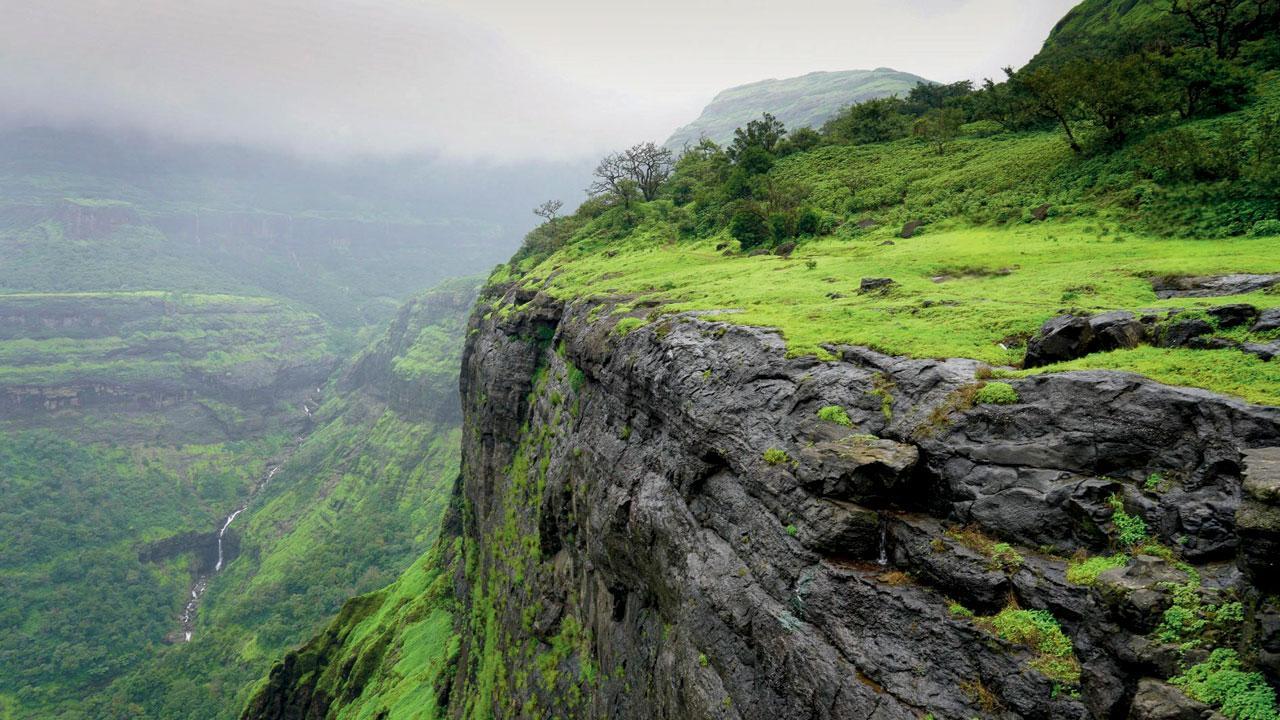
Kalsubai to Devkund: Seasoned trekkers share their favourite routes to trek this monsoon

Aadrai forest

Aadrai forest


The Aadrai forest located in Malshej Ghat passes through a jungle that promises breathtaking views of the Kalu waterfall. As one navigates the trail, they will encounter other cascading waterfalls. The trek is best undertaken during the monsoon as the landscape is lush and covered with mist. This easy and enjoyable hike is ideal for beginners. The three-hour one-way journey mostly comprises a flat walk, making it suitable for first-time hikers.


Difficulty level:  Easy. A compulsory guide is needed; trekkers can lose their way.


How to reach: The trail starts from Khireshwar village in Junnar taluka. Mumbai to Khireshwar village is 160 km. Board a Kalyan-bound train and from the station, hire a jeep headed towards Junnar; alight at Khubi Phata, or take the jeep to Khireshwar. Public transportation is limited. A bus plies towards Junnar from Kalyan bus depot. Alight at Khubi Phata. From this point, it’s a six-kilometre walk to Khireshwar village.

2,506 feet
Maximum altitude

Devkund waterfall trek

The ladders at Kalsubai provide a unique experience and add excitement to the journey

This destination is nestled deep in a forest; the waterfall offers a spectacular display of nature’s force. The journey to the waterfall takes approximately three hours from the base, covering nearly five kilometres of walking (one way) with views of diverse flora and fauna. The total time is about six hours. Its highlight is the magnificent waterfall. 

Difficulty level: Moderate. A guide is compulsory. Avoid trekking during heavy rains.

How to reach: The trail begins at Patnus, in Pali. The nearest railway station is Nagothane or Khopoli. From either of these stations, hire an autorickshaw.  Maharashtra state transport buses are available but with limited frequency. The distance from Mumbai to Patnus village is 124 km (four hours).

516 feet
Maximum altitude

Kalsubai

The ladders at Kalsubai provide a unique experience and add excitement to the journey

The Kalsubai trek takes you to the summit of Maharashtra’s highest peak (1,646 meters) and also offers breathtaking views of the surrounding landscape, including the Harishchandragad Wildlife Sanctuary and the Bhandardara dam. The period before the monsoon arrives allows trekkers to witness captivating cloud formations and, if lucky, an opportunity to capture the Milky Way through astrophotography. The clear skies and stunning vistas make it a paradise for photographers and nature enthusiasts. To ensure the safety of trekkers, three large ladders have been installed along the trail, making the climb more secure and accessible. The ascent typically takes around four hours, and the descent follows a similar time frame. It takes eight hours to complete the trek. 

Difficulty level: Moderate

How to reach: The trail begins at Bari village in Igatpuri. Mumbai to Bari village is 160 km (five hours). The nearest railway station is Kasara. Rail is the cheapest and fastest mode to reach the base village. Board a Kasara-bound train, and hire a jeep from Kasara to reach Bari. State transport buses heading to Shendi village or Rajur village also halt at Bari.

Manasi Kedar, operations head, Treks and Trails

5,400 feet
Maximum altitude

Tung fort

This fort also known as Kathingad, owing to the steep access to the fort (Kathin: difficult in Marathi and Hindi), is a popular trekking destination near Lonavala in the Sahyadris. The conical peak is a distinct feature and the fort can be recognised easily from a distance. The starting point is the Tungwali village. There are multiple routes to reach the fort. The most common one is a well-defined trail that starts near the village and leads you uphill. As you ascend, you’ll pass through dense forests, rocky patches, and steep slopes. The trail can be challenging in certain sections. The fort’s ruins include the main entrance, bastions, water tanks, and a few temples. It has historical significance and was built during the Adil Shahi dynasty but was captured by the Marathas and used as a watchtower. It offers splendid views of the Sahyadris and Pawna lake.

Difficulty level: Moderate. For regular trekkers, this might seem like an easy one.

How to reach: Tungwadi is the base village and is accessible by road. It is 115 km from Mumbai. Trekkers can drive or take public transport to Lonavala. From here, catch a bus to Aamby Valley and alight at Ghusalkhamb village. It will take roughly one and a half hours (eight kilometres) to reach Tungwadi on foot. Local taxis or autorickshaws ply from Lonavala.

Jayesh Paranjpe, founder, Western Routes

3,526 feet
Maximum altitude

Manikgad fort

This 18th century hill fort in ruin — built by Maratha naval chief Kanhoji Angre to oversee the trade route from Maval to the coastal ports — stands testimony to the architectural foresight of the Maratha Empire. Look out for a big rock-cut tank called the ‘Darya Take’. The trek starts at Vashivali village, 25 km from Panvel. The trail passes through a forest and opens to a plateau which is ideal to spot the rufous treepie, red vented bulbul, purple sunbird, shikra and the green bee eater, among others. After crossing the plateau, the path leads through a dense forest. In the last stretch, traverse carefully since it covers rocky terrain. It takes approximately four hours to reach the summit; 30 minutes to explore the fort, and approximately two hours for the descent. To avoid harsh sun, start at dawn so it’s possible to reach the top before 10 am. The total trek distance is 10 km.

Difficulty level: Moderate to difficult. Prior trekking experience in the Sahyadris is preferable.

How to reach: From Panvel station, hire a taxi or rickshaw to Vashivali. Alternatively, reach Vashivali directly via a private vehicle.

1,878 feet
Maximum altitude

One tree hill

One Tree hill

The trek starts from Ambewadi in Karjat, and ends in Matheran. Beginning from the fields of this village, it takes trekkers through lush forests to the finishing point, which is a hill with one tree. The views are spectacular, with the massive Morbe dam on the east, and Irshalgad and Prabalgad forts to the west. While this route is accessible all year, it is prettiest in the monsoon. After a climb (3 to 3.5 km) tread through a green trail (3 km flat walk) to Matheran. Post lunch, head to Dasturi from where Neral station is accessible via taxi. The distance of this trek is six kilometres.

Difficulty level: Easy to moderate. Basic fitness levels are ideal to enjoy this trek.

How to reach: Board a Karjat-bound train and hire a taxi to Ambewadi, the base village. Alternatively, directly reach Ambewadi by private vehicle.

Ankit Naithani, founder Wandering Boots Adventures

2,500 feet
Maximum altitude

"Exciting news! Mid-day is now on WhatsApp Channels Subscribe today by clicking the link and stay updated with the latest news!" Click here!

Register for FREE
to continue reading !

This is not a paywall.
However, your registration helps us understand your preferences better and enables us to provide insightful and credible journalism for all our readers.

Mid-Day Web Stories

Mid-Day Web Stories

This website uses cookie or similar technologies, to enhance your browsing experience and provide personalised recommendations. By continuing to use our website, you agree to our Privacy Policy and Cookie Policy. OK