shot-button
Lake Levels Lake Levels
Home > Mumbai > Mumbai News > Article > Mumbai weather report Partly cloudy with possibility of rain and strong Winds

Mumbai weather report: Partly cloudy with possibility of rain and strong Winds

Updated on: 13 June,2023 08:59 AM IST  |  Mumbai
mid-day online correspondent |

The high tides for today in Mumbai are scheduled to occur at 08:30 hours with a height of 3.71 meters, followed by another high tide at 20:12 hours, which will reach a height of 3.75 meters
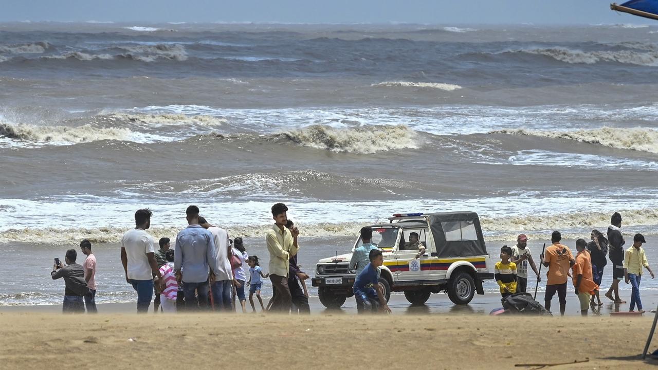
Mumbai weather report: Partly cloudy with possibility of rain and strong Winds

Looking ahead to tomorrow, on June 14, 2023, a low tide is anticipated at 0249 hours with a height of 1.05 meters. Pic/PTI

Today, June 13, the weather forecast for Mumbai indicates a partly cloudy sky with the likelihood of light to moderate rain or thundershowers in the city and its suburbs. Residents should be prepared for occasional strong winds with speeds reaching 45-55 kmph. Hot and humid conditions are expected to persist throughout the day in both the city and its suburbs.


The high tides for today are scheduled to occur at 08:30 hours with a height of 3.71 meters, followed by another high tide at 20:12 hours, which will reach a height of 3.75 meters. In contrast, the low tide is expected at 14:05 hours, measuring 1.94 meters. Looking ahead to tomorrow, on June 14, 2023, a low tide is anticipated at 0249 hours with a height of 1.05 meters.


Temperature-wise, in the Colaba area, the maximum temperature is forecasted to reach 33.4 °C, while the minimum temperature will be around 27.5 °C. Moving towards Santacruz, residents can expect a higher maximum temperature of 36.8 °C, with a minimum temperature of approximately 27.9 °C.


As Mumbai wakes up to a partly cloudy sky, there is a chance of rainfall and thundershowers throughout the day. It is advisable for citizens to be cautious and take necessary precautions due to the occasional strong winds with speeds of 45-55 kmph.

Meanwhile, much-awaited monsoon winds have started advancing towards the Konkan region, but will take a few more days to reach Mumbai, meteorologists have predicted. The delay in their advancement over the north Konkan region is likely caused due to Cyclone Biparjoy moving north.

Elaborating on the same, climatologist Rajesh Kapadia from private blog Vagaries of Weather said, “The cyclone (Biparjoy) is moving inland, disturbing the gradient along the West Coast, thus delaying the monsoon advancement beyond south Konkan.” According to Kapadia, the pre-monsoon showers will continue, but their intensity will reduce after Wednesday. “Mumbai may see the onset of monsoon after June 16,” he said, adding that the water level in lakes is currently at 11 per cent, which will last for a month.

According to private forecasting agency Skymet Weather Services, after the onset over Kerala on June 8, the monsoon westerly stream rapidly travelled along the coast to go past Goa and reached Ratnagiri on June 11. “Cyclone Biparjoy is moving northward very slowly and is likely to change course northeastward in the next 24 hours. It will make landfall on June 15 near the Indo-Pak border. The northern limit of monsoon (NLM) will also move along with the storm, getting dragged to cover the Konkan region and even ingress south Gujarat in the next two to three days,” the Skymet website said.

"Exciting news! Mid-day is now on WhatsApp Channels Subscribe today by clicking the link and stay updated with the latest news!" Click here!

Register for FREE
to continue reading !

This is not a paywall.
However, your registration helps us understand your preferences better and enables us to provide insightful and credible journalism for all our readers.

Mid-Day Web Stories

Mid-Day Web Stories

This website uses cookie or similar technologies, to enhance your browsing experience and provide personalised recommendations. By continuing to use our website, you agree to our Privacy Policy and Cookie Policy. OK