shot-button
HMPV HMPV
Home > News > India News > Article > Cyclone Tauktae weakens after making landfall on Gujarat coast

Cyclone Tauktae weakens after making landfall on Gujarat coast

Updated on: 18 May,2021 12:00 AM IST  |  Diu
PTI |

State officials said there are no reports of any casualty due to the tropical storm Tauktae, adding it has weakened.

Cyclone Tauktae weakens after making landfall on Gujarat coast

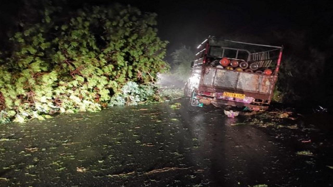
A truck loaded with oxygen cylinders stuck as trees fell due to impact of cyclone Tauktae, near Mahuva, in Gujarat. Pic/AFP

The landfall process of the eye of extremely severe cyclonic storm Tauktae, which hit the Gujarat coast in Saurashtra region between Diu and Una, ended around midnight, the India Meteorological Department (IMD) said on Tuesday.


State officials said there are no reports of any casualty due to the tropical storm Tauktae, adding it has weakened.


The IMD also announced that the cyclone has weakened into a ''very severe cyclonic storm'' from the ''extremely severe cyclonic storm''.


"The entire eye of the cyclone has now crossed the coast and lies over land. The rear sector of the eye is now entering the land," the IMD said in a tweet after midnight.

Landfall is the storm moving over the land after its intensification in the ocean (heat source). A cyclone is said to make landfall when the centre of the storm (eye) moves across the coast.

The landfall brings with it high-speed winds, severe storm surge and torrential downpour. The storm usually weakens rapidly after landfall as the ocean heat and moisture that fuels it are no longer available.

The cyclone hit the coast between Diu and Una around 9 pm on Monday and ended around midnight, the IMD said.

The state government had shifted over two lakh people to safer locations before the cyclone hit the Gujarat coast.

The place above which the eye of a cyclone crosses is designated as the place of landfall, an official said.

The landfall process started with the entry of the "forward sector of the eye of the cyclone" into the land near the Union Territory of Diu with a wind speed of between 150 and 175 km per hour, IMD officials said.

The cyclone brought gusty winds and heavy rains on the entire coastal belt, uprooting trees in Junagadh, Amreli and Bhavnagar districts, said district officials.

The regional meteorological centre said the cyclone will move towards northern Gujarat.

"It will move towards Amreli district and then towards Banaskantha after crossing Surendranagar district. We expect it will weaken as it moves forward," an official said.

While there are no reports of any human injury or death, gusty winds coupled with heavy rain uprooted several trees and electricity towers on the coastal belt, another official said.

The cyclone winds also caused road blockage and power outages in many villages of these districts.

Gujarat Chief Minister Vijay Rupani had said before the landfall that coastal districts of Amreli, Junagadh, Gir- Somnath and Bhavnagar will face the maximum brunt as the wind speed would go up to 150 kmph when the eye of the storm would make landfall.

A major cyclone in Gujarat on June 9, 1998, had brought widespread death and destruction in its wake, particularly in the port town of Kandla.

While official figures had then put the death toll at 1,173, adding 1,774 went missing, media reports, eyewitness and volunteer accounts suggested that this was grossly an understatement.

A leading news magazine had then claimed that at least 4,000 people had died and countless went missing as bodies were washed to the sea.

This story has been sourced from a third party syndicated feed, agencies. Mid-day accepts no responsibility or liability for its dependability, trustworthiness, reliability and data of the text. Mid-day management/mid-day.com reserves the sole right to alter, delete or remove (without notice) the content in its absolute discretion for any reason whatsoever.

"Exciting news! Mid-day is now on WhatsApp Channels Subscribe today by clicking the link and stay updated with the latest news!" Click here!


Mid-Day Web Stories

Mid-Day Web Stories

This website uses cookie or similar technologies, to enhance your browsing experience and provide personalised recommendations. By continuing to use our website, you agree to our Privacy Policy and Cookie Policy. OK