An American foundation has been quietly working with local authorities and planning agencies to transform 20 crash prone intersections into pedestrian-happy crossings. And the results are showing

CSMT, where changes will be implemented early next year, will see former NYC traffic commissioner and champion of pedestrians, Janette Sadik-Khan, and team lengthen medians and broaden refuge islands to allow people to negotiate the four intersections saf
At 12.30 PM on a weekday, the main intersection outside Chhatrapati Shivaji Maharaj Terminus CSMT is not as chaotic as it will be five hours later, when rush hour traffic transforms the pocket into a mind-numbing bedlam. Yet, a family with three children, which is attempting to cross over, appears to be walking on eggshells.
ADVERTISEMENT
That this crossing is split into four junctions makes negotiating it tricky. Add to this, pedestrians always take the shortest route, when crossing. Abhimanyu Prakash, urban designer and architect, describes it as the "goats- trail".
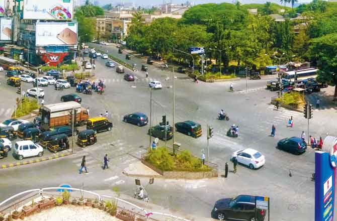
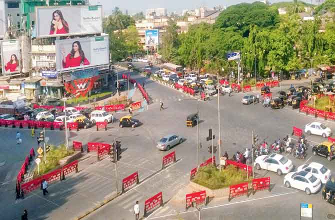
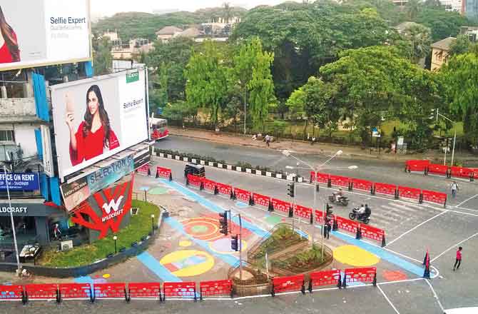
Bandra-s chaotic HP Junction is now pedestrian-friendly after an experiment with barricades
He explains the analogy thus: "When you go to the mountains, you see tiny tracks created on the ground by goats walking them. It-s usually the shortest path they take to reach their destination. Humans are no different. You can paint a zebra crossing wherever you want, but we will take the shortest route. Always."
The fact that this shortest route could be the most perilous is hardly ever considered. Not to mention the lack of focus on pedestrian infrastructure in Mumbai-s road design plan, an issue emblematic of most megalopolises across the world. In short, this means that sidewalks, zebra crossings and refuge islands are either in wanting or unevenly distributed.
According to the World Health Organization report on Road Safety 2018, released this week, deaths from road traffic crashes have increased to 1.35 million a year, globally. "That-s nearly 3,700 people dying on the world-s roads every day," Dr Tedros Adhanom Ghebreyesus, director-general, WHO, was quoted as saying in the report. Even the Mumbai Road Safety Report of 2017 — a joint collaboration between the Mumbai Traffic Control Branch and the Bloomberg Philanthropies Initiative for Global Road Safety BIGRS — pegged crashes involving pedestrian at 52 per cent of the total accidents last year.
But, Mumbai seems determined to do something to rectify the mess. It is in the process of seeing 20 of its major intersections — all black spots, where road traffic crashes have been highly concentrated — into pedestrian-friendly zones. Spearheading the drive is a group of young road engineers and transport planners from across associations that are partnering closely with the BIGRS, the BMC and Mumbai Traffic Police for the last two years and more, to change the dynamics and designs of our roads.
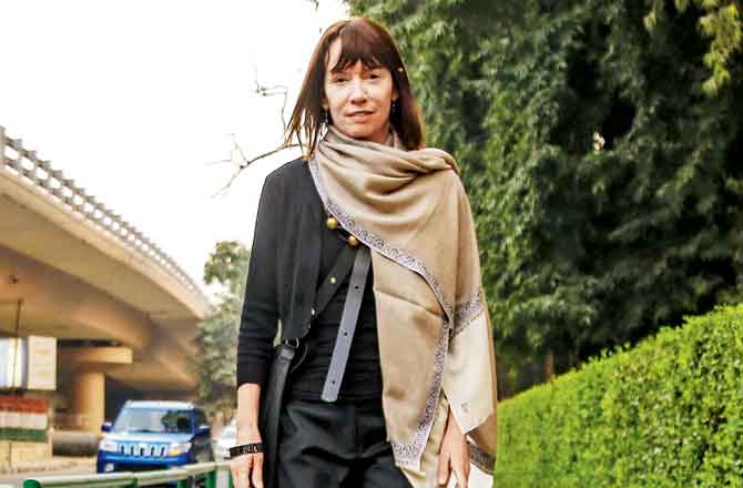
Janette Sadik-Khan
The initiative is the result of a Memorandum of Understanding MoU signed between Chief Minister Devendra Fadnavis and Michael Bloomberg in March 2015, when 10 cities across five countries were selected to participate in a new phase of the foundation-s Global Road Safety Initiative, which aims to reduce fatalities and injuries from road crashes.
Janette Sadik-Khan, who served as Commissioner of the New York City Department of Transportation from 2007 to 2013, where she implemented an ambitious programme to improve safety, mobility and sustainability and ensure a state of good repair on the city-s roads, bridges and ferries, was recently in Mumbai to oversee the project for the transformation of CSMT, an intersection shortlisted for the makeover. At Bloomberg Associates, she works with mayors around the world to reimagine and redesign their cities with innovative projects that can be developed quickly and inexpensively, says the foundation-s website.
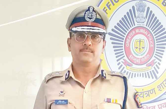
Amitesh Kumar
"Mumbai is expected to add six million people in the next six years. That-s adding almost a city-s worth of people every year. Despite this growth, the response by city planners has been to build more and wider roads, which only increases driving and pushes everyone else to the side. This is an incredible cost implication for cities. It strains the economy with traffic and caps a city-s ability to grow. It creates streets that are dangerous for people to walk and bike on, and this, in turn, creates streets that are unattractive and uninviting and takes away from what makes cities great," Sadik-Khan told mid-day in an email interview.
The problem, she points out, is that most traffic engineers are following street design guides that were written half a century ago. These focus on designing streets to move cars as quickly as possible from one point to another, and see people on foot or riding bikes as problems to be engineered out of the equation. As a solution, Sadik-Khan and her team compiled a Global Street Design Guide based on proven designs and ideas from 72 cities in 42 countries, which will now be implemented in Mumbai. "The guide shows how even streets in Mumbai can be redesigned to make them safer and easier to live, work and play on, and how roads can support the businesses, public transport and institutions that rely on them."

Vinod Chithore
Discussing how the process works, Amitesh Kumar, joint commissioner of police, traffic, Mumbai, said, "We are given the road design changes by the various agencies partnering with BIGRS." Based on the changes, temporary interventions are undertaken at the said intersections, including using barricades and traffic cones, painting new markers to highlight zones for sidewalks, refuge islands, and parking and car lanes, as well as introducing street furniture and planters.
"If the experiments are successful, the traffic police will coordinate with the BMC to make these changes permanent," he said, adding, "It-s a very effective measure. At crossings where work is already underway [LBS Marg, Vikhroli and HP Junction, Bandra West], we-ve got feedback that pedestrians are happier, and that the conflict [between motorists and pedestrians] has reduced considerably."
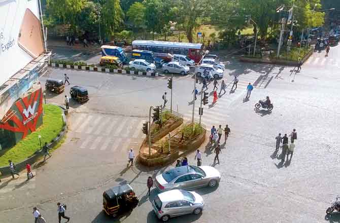
Work has already begun on implementing permanent changes in five of the 20 intersections, said Vedant Goyal, road design and transportation coordinator, BIGRS. Vinod Chithore, director, engineering services and projects, BMC, said, "It is challenging to implement a new road engineering programme like this one, but everyone right from the ward level, to the different city bodies and traffic police, have been coordinating, and working effectively to make this work.
We are also using the expertise provided by Bloomberg, to train our engineers to build and re-engineer existing roads across the city, on the same lines."
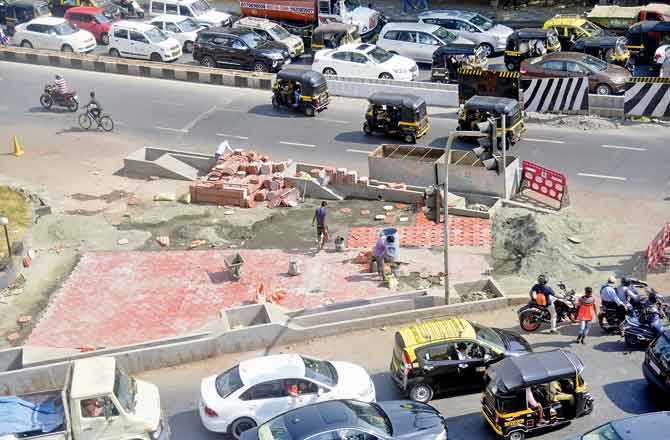
The narrow turn connecting Link Road and SV Road outside the entrance to Wildcraft store was painted temporarily in March last year, so that it could be used for pedestrian movement only. After a successful 45-day trial, work on paving the stretch began this year. Pics/Sameer Markande, World Resources Institute
The results look promising. According to Kelly Larson, programme director for road safety at Bloomberg Philanthropies, ever since the implementation of the project, road crash fatalities are down by 20 per cent.
Chhatrapati Shivaji Maharaj Terminus Csmt
Abhimanyu Prakash, who is also programme manager of National Association of City Transportation Officials – Global Designing Cities Initiative NACTO – GDCI, and is working closely with Sadik-Khan to propose design changes at CSMT-s four intersections, points out how currently, the road at DN Road in Fort, which is a single car lane, breaks into three lanes as it reaches CSMT, further widening into eight lanes, before splitting into two and three lanes respectively.
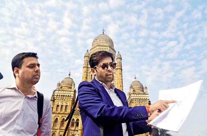
Vedant Goyal, road design and transportation coordinator with BIGRS, and Abhimanyu Prakash of NACTO – GDCI at CSMT. Pic/Atul Kamble
"If water coming from a 2 mm pipe is routed through a 5 mm one, the volume of water stays the same. But when you pour water from an 8 mm pipe through a 5 mm one, it will either cause an overflow or blockage.
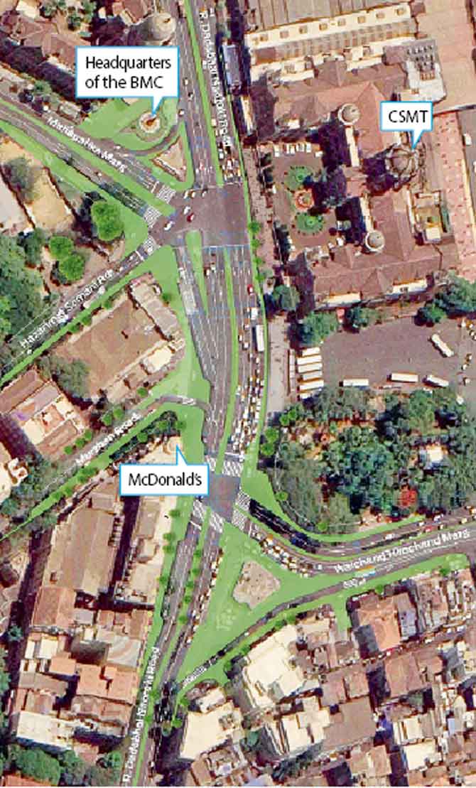
The arrows in the brown stretches indicate how Abhimanyu Prakash and team have kept the lane constant 4 lanes on DN Road, Hazarimal Somani Marg, Mahapalika Marg and Walchand Hirachand Marg. Space has been etched out for a sidewalk around the selfie point outside the BMC HQ to allow pedestrians to walk safely
This is what is happening with the traffic at CSMT," he says. The changes Prakash and team outline will be incorporated temporarily in the first half of next year.
NACTO proposes
. Keep lane alignment constant. At DN Road, for instance, have a single travelling lane, and use the other as a multi-purpose zone, which during the day, will be used for parking and at night, for loading and unloading activities
of trucks.
. Single lane to open into two lanes instead of eight, to prevent bottlenecks. Extra dead space used to widen sidewalks by 1 to 1.5 m, to improve pedestrian movement.
. Medians dividers at all critical points of the junctions to be lengthened, so that the crossings are closer to where the fence lining the CSMT building ends.
. Refuge island at medians, where pedestrians wait before crossing over, to be broadened. "Currently, the refuge island is too narrow. We need to create a ramp, and space for two wheelchairs to stand at the same time, and to be able to turn around," says Prakash.
Dharavi Depot
Dharavi depot has a straightforward intersection. Prakash and the team at NACTO are currently working on preparing a detailed survey of the pedestrian footfall and traffic flow, as well as fatalities reported at the site.
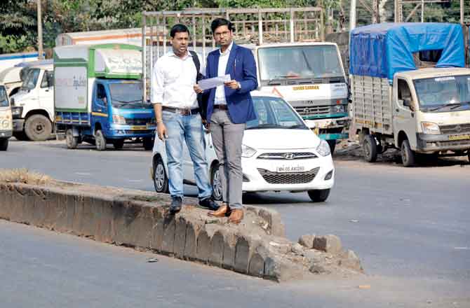
Prakash and team have proposed extending the medians at the Dharavi Depot intersection, and making provision for refuge islands. Pic/Sayyed Sameer Abedi
"Like CSMT, here, we will maintain the number of effective lanes and balance the input and output of travel lanes from either side of the intersection," says Prakash. At present, there is no sidewalk for people to walk on the Dharavi Depot Road. While the shops along the line will not be touched, NACTO has proposed constructing sidewalks on both stretches.
P D-Mello Road
This 6 km-long stretch connects Colaba with the Eastern Freeway, and witnesses heavy pedestrian traffic, through the day. A detailed assessment conducted by the International Road Assessment Program iRAP and World Bank, which partnered with BIGRS for this corridor, pegged the pedestrian traffic at 1,000 people per hour during peak time.
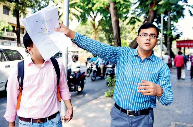
Jigesh N Bhavsar, senior road safety engineer with iRAP has proposed a host of changes on the 6 km-long P D’Mello Road stretch. Pic/Bipin Kokate
Jigesh N Bhavsar, senior road safety engineer with iRAP says there was an urgent need to consider pedestrian safety on this road, because it has seen 22 deaths in road crashes since 2015. While the sidewalks are broader than 3 metres on the stretch near the RBI building, it narrows towards the freeway. Work on this stretch is expected to begin next year.
iRAP-World Bank propose
. Building speed bumps at four sites.
. Raised and signalised crossings at six sites respectively to allow for free pedestrian freely.
. Warning signs for speeds humps.
. Installing a push-to-walk button that makes the -walk- signal appear in a traffic signal, at the busy intersection near Shahid Bhagat Singh Road, so that pedestrians can signal vehicular traffic to stop when needed.
HP Junction, Bandra W
This intersection connects three major arterial roads in the western suburbs of Mumbai and sees over 5,000 vehicles — and an equivalent number of pedestrians — during peak hour. While only three deaths due to road crashes were reported between 2015 and 2017 at this junction, injury toll could have been higher, Goyal of BIGRS said.
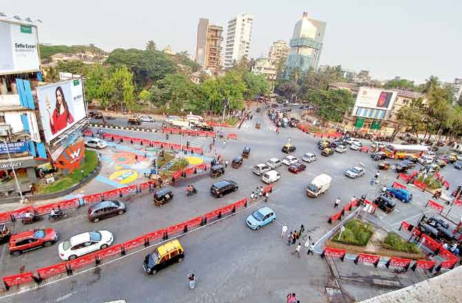
The red barricades installed in 2017 indicate how the project separates auto movement areas from pedestrian movement stretches avoiding a situation, where pedestrians are walking head on into cars
One of the major concerns on this stretch was that intersection area had several undefined spaces and pedestrian crossings often ran into dead ends. Improper median placements and lack of pedestrian refuge islands, meant that pedestrians were spilling onto the road, more often than not.
After a successful 45-day trial in March last year, where over 100 barricades and painted signs were used to re-direct pedestrian traffic, work on the project took off. While the project will take another few months to complete, the WRI India team says it has already led to a 30 per cent reduction in pedestrian crossing distances.
Changes made
. The intersection area has now been made more compact — from 1,423 sqm to 1,000 sqm, so that there is no residual space to leave room for conflict between pedestrians and motorists. The traffic islands, which were previously ornamented with plants, have now been converted into huge refuge islands
or assembly zones, further reducing the crossing distance.
. As per international design guides, pedestrians should not be allowed to cross more than three car lanes without a refuge island. The same principle was followed here.
. Lanes were realigned for better channelisation of traffic.
. The turn connecting Link Road and SV Road was paved, and will be used for pedestrian movement only.
Gandhinagar Junction, LBS Marg in Vikhroli
When the team at World Resources Institute WRI started work on LBS Road back in 2016, they found several issues on the 10-km corridor. "Our surveys showed that in certain sections of the corridor, pedestrians actually outnumbered motor vehicles," said Binoy Mascarenhas, an economist urban planner and head of integrated transport at WRI. Reports cited that 57 people had lost their lives to road crashes, between 2015 and 2017, on this stretch alone, making it one of the riskiest belts for pedestrians.
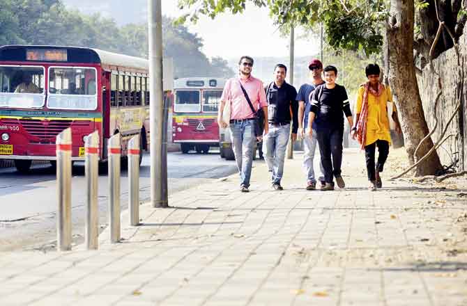
From left Dhawal Ashar, Goyal, Binoy Mascarenhas and Saurabh Jain of WRI and BIGRS, had first mooted the plan of widening the sidewalk at LBS Marg near Gandhinagar, Vikhroli. Work has already begun on a 2-km stretch. Pic/Sameer Markande
The reasons for this statistic were discontinuous and inadequate sidewalks, insufficient waiting area for bus passengers, lack of pedestrian crossings between opposite bus stops and lack of signages at mid-block U-turning areas."If you design for pedestrians, it will improve vehicular efficiency as well. If footpaths are not accessible, pedestrians will walk on the carriageway [car lanes], putting themselves at risk, and also reducing carriageway capacity," says Dhawal Ashar, manager, integrated transport at WRI.
Work at LBS Marg is already underway on a 2-km stretch. At present, they have provided two consistent car lanes, the sidewalks have been extended by nearly three metres, and the illegal parking lane has been completely done away with. Where extra space was available, they have made room for autorickshaws to park, so that they don-t stop on the car lanes to pick up passengers. Provisions have also been made for a mid-block crossing every 200-250 metres, with a ramp to allow for wheelchair movement. "If you have properly designed crossings at regular intervals with some form of calming, it controls the speed of vehicals and reduces crash severity," says Saurabh Jain, senior project associate, sustainable cities and transport.
Catch up on all the latest Crime, National, International and Hatke news here. Also download the new mid-day Android and iOS apps to get latest updates
 Subscribe today by clicking the link and stay updated with the latest news!" Click here!


