The IMD said the south west monsoon had reached Andaman and Nicobar Islands in the Bay of Bengal and a cyclonic circulation formed there is likely to bring thunderstorms along with lightning and gusty winds with speeds of 30-40 kilometres per hour in central Maharashtra, Konkan and Goa

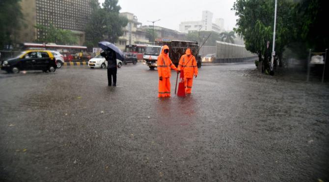
A flooded street in Mumbai following heavy rains due to cyclone Tauktae, pic: Shadab Khan
A cyclonic circulation in the Bay of Bengal may intensify in the next couple of days and bring showers in some parts of coastal Maharashtra, except Mumbai, and central parts of the state, the India Meteorological Department said on Saturday.
ADVERTISEMENT
It said the south west monsoon had reached Andaman and Nicobar Islands in the Bay of Bengal and a cyclonic circulation formed there may turn into a "very severe cyclonic storm" by May 25.
Also read: Cyclone Yaas likely to intensify into very severe cyclonic storm, says IMD
This development is likely to bring thunderstorms along with lightning and gusty winds with speeds of 30-40 kilometres per hour in central Maharashtra, Konkan and Goa on Monday and Tuesday, the IMD said in its forecast.
It has also predicted a rise in temperature by 2 degrees Celsius to 3 degrees Celsius in the next five days in most parts of Maharashtra.
This story has been sourced from a third party syndicated feed, agencies. Mid-day accepts no responsibility or liability for its dependability, trustworthiness, reliability and data of the text. Mid-day management/mid-day.com reserves the sole right to alter, delete or remove (without notice) the content in its absolute discretion for any reason whatsoever
 Subscribe today by clicking the link and stay updated with the latest news!" Click here!


